Файл:India Telangana locator map.svg

Повна роздільність (SVG-файл, номінально 1639 × 1852 пікселів, розмір файлу: 795 КБ)
| Відомості про цей файл містяться на ВікіСховищі, централізованому сховищі вільно розповсюджуваних зображень та мультимедіа для використання у проектах Фонду Вікімедіа. |
| Назва |
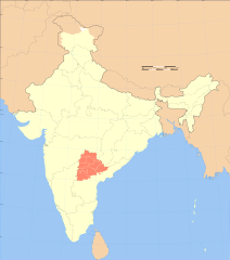
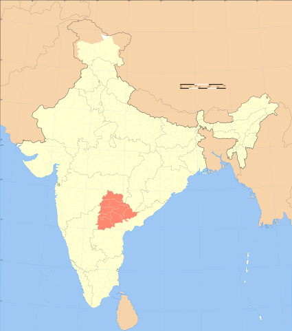
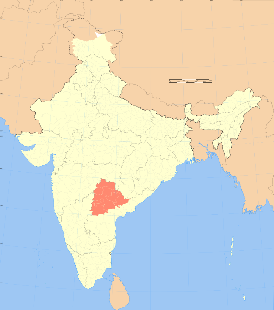
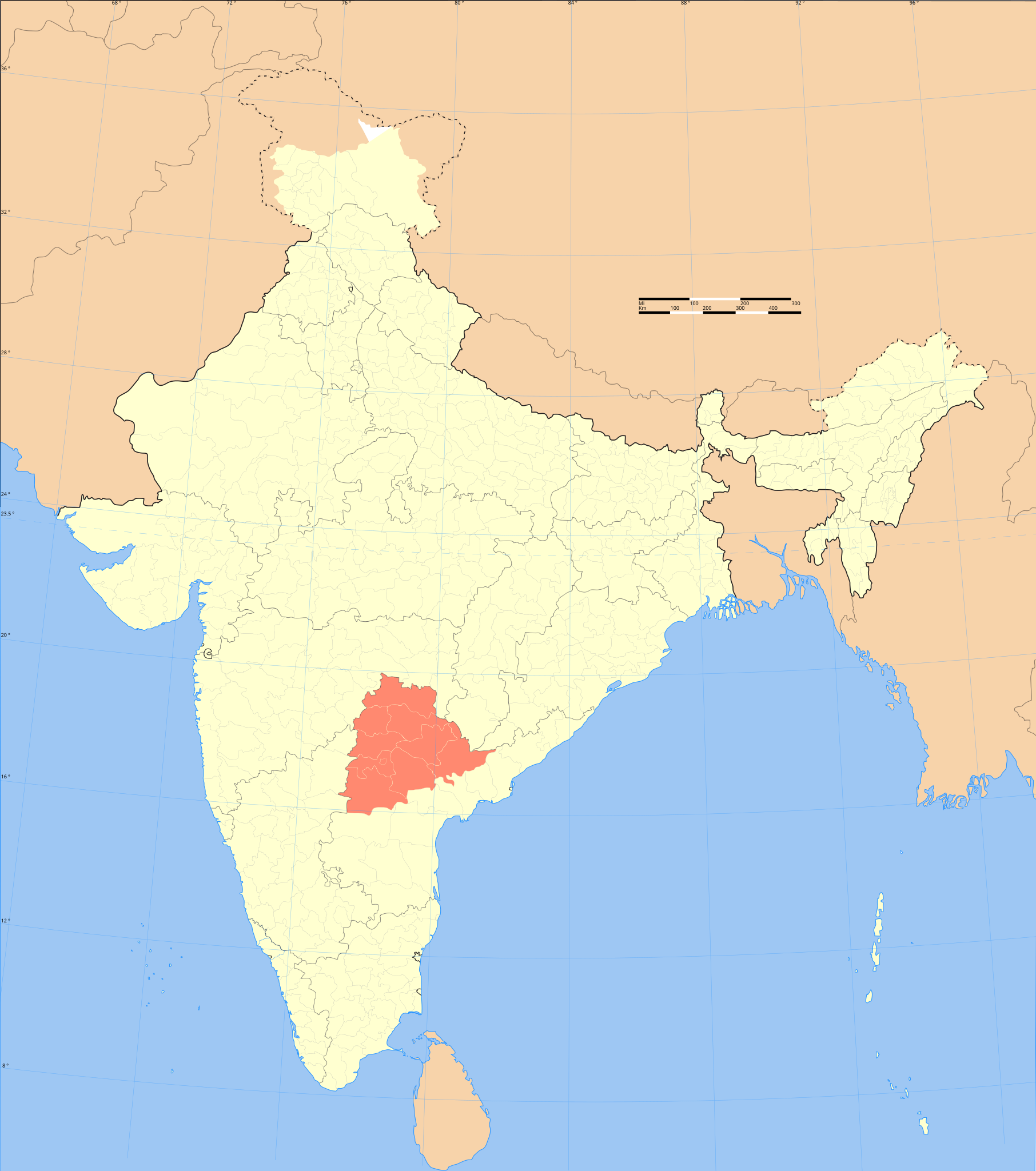
Telangana locator map |
|||||||||
| Опис | ||||||||||
| Легенда мапи |
 |
|||||||||
| Час створення | ||||||||||
| Джерело |
Власна робота |
|||||||||
| Творець |
|
|||||||||
| Ліцензія (Повторне використання цього файлу) |
Я, власник авторських прав на цей твір, добровільно публікую його на умовах такої ліцензії: Цей файл ліцензований на умовах Creative Commons Attribution-Share Alike 3.0 Unported
|
|||||||||
| Geotemporal data | ||||||||||
| Зображений час | друга половина XX ст. та XXI ст. | |||||||||
| Система просторової прив'язки | conic | |||||||||
| Територіальне обмеження |
|
|||||||||
| Геоприв'язка | Якщо недоречно, будь ласка, визначте warp_status = skip щоб приховати. | |||||||||
| Archival data | ||||||||||
| Нотатки | Part of WikiProject India Maps | |||||||||
| SVG розвиток | Вихідний код цього SVG-файлу неправильний. Це векторне зображення було створено з допомогою Adobe Illustrator |
|||||||||


Notes
Depiction of India's borders
- The territorial boundaries of India are shown as per the actual ground situation in accordance with international practices followed by the United Nations ([2], [3]) and the National Geographic Society ([4], [5])
- This map is meant to be for illustrative purpose only and is not authenticated by official government sources. Please check the list of sources and references used to create the map for a measure of accuracy and verifiability.
- The usage of these maps in India, Pakistan and China are governed by different laws that restrict depictions of boundaries other than what is officially recognized by the state. Please check local laws and modify the map accordingly before use.
Explanation of disputed boundaries


- Boundary of Indian claim : The territory India claims is legally theirs, but the claim is disputed by China and Pakistan.
- Line of Control/Line of Conflict : The de facto administrative boundary recognised by the international community. This UN ceasefire line is considered as a temporary solution to an ongoing conflict since the departure of the British Raj.
Borders of disputed regions
The depicted extent of the former territory of the British Indian Empire, succeeded by Republic of India, may not be accepted by few countries as legal due to ongoing border disputes:
- The northern Himalayan region of the disputed territory Indian-administered Kashmir is claimed by India including (Pakistan-administered Kashmir) and the Chinese-occupied territory of (Ladakh plateau). Since 1972, it is divided between all three countries. See also Line of Control and Line of Actual Control.
- Siachen glacier (shown white) is an actively contested region between India and Pakistan. Since 1984, the region is under Indian control.
- The northeastern territory of Arunachal Pradesh is almost entirely claimed by China as part of its Tibetan territory.
- Minor areas of eastern Kashmir's Ladakh division, Himachal Pradesh and Uttarakhand on the Chinese frontier are claimed by China. These areas are under Indian control.
- A small area of Uttarakhand adjoining the Nepal border along the Sarda river is disputed between the two countries.
For a detailed map of all disputed regions in South Asia, see Image:India disputed areas map.svg
Internal borders
The borders of the state of Meghalaya, Assam and Arunachal Pradesh are shown as interpreted from the North-Eastern Areas (Reorganisation) Act, 1971, but has yet to be verified.
Territorial waters
The limit of the territorial waters of India extends to twelve nautical miles measured from the appropriate baseline. See this for more information.
Історія файлу
Клацніть на дату/час, щоб переглянути, як тоді виглядав файл.
| Дата/час | Мініатюра | Розмір об'єкта | Користувач | Коментар | |
|---|---|---|---|---|---|
| поточний | 19:14, 20 травня 2008 | | 1639 × 1852 (795 КБ) | Planemad | {{WikiProject_India_Maps |Title=Telangana locator map |Description=Locator map of the region of Telangana, India with district boundaries. |Source=. |Date=September 2006 |Author={{User:PlaneMad/Info}} }} |
| 17:52, 4 вересня 2006 |  | 1639 × 1852 (795 КБ) | Planemad | {{WikiProject_India_Maps |Title=Telangana locator map |Description=Locator map of the region of Telangana, India with district boundaries. |Source=. |Date=September 2006 |Author=w:user:Planemad |Thumbdir=CHANGE }} |
Використання файлу
Така сторінка використовує цей файл:
Глобальне використання файлу
Цей файл використовують такі інші вікі:
- Використання в as.wikipedia.org
- Використання в az.wikipedia.org
- Використання в ba.wikipedia.org
- Використання в be.wikipedia.org
- Використання в bg.wikipedia.org
- Використання в br.wikipedia.org
- Використання в ca.wikipedia.org
- Використання в cdo.wikipedia.org
- Використання в ceb.wikipedia.org
- Використання в da.wikipedia.org
- Використання в de.wikipedia.org
- Використання в dty.wikipedia.org
- Використання в en.wikipedia.org
- List of Telugu-language television channels
- Wikipedia:WikiProject Indian maps
- Wikipedia:WikiProject India
- User:Bsskchaitanya
- History of Andhra Pradesh
- Telangana movement
- User:Suhebriazsaifi
- User:Hariehkr
- 1969 Telangana Agitation
- Template:User Telangana movement
- Wikipedia:Top 25 Report/July 28 to August 3, 2013
- User:Anirudh.palakurthi
- User:Pranayraj1985
- Wikipedia talk:Noticeboard for India-related topics/Archive 57
- User:Rizwanmahai
- List of governors of Telangana
- Template:User WP Telangana/doc
- Template:User Telangana/doc1
- Template:User in Telangana
- Template:User in Telangana/doc
- Category:Wikipedians in Telangana
- Template:User interest Telangana
- Template:User interest Telangana/doc
- Wikipedia:WikiProject Telangana
- Template:User citizen Telangana
- Template:User citizen Telangana/doc
- Template:User from Telangana
- Template:User from Telangana/doc
- User:JohnnyBlaze007
- Wikipedia:Userboxes/Life/Ethnicity/02
- User:Haseeb1608
- User:WeAreCreative
- User:Smadhavichandra
- Category:Wikipedians interested in Telangana
- User:Sagavaj
- Wikipedia:WikiProject India/Templates
- Wikipedia:WikiProject India/userbox templates
Переглянути сторінку глобального використання цього файлу.